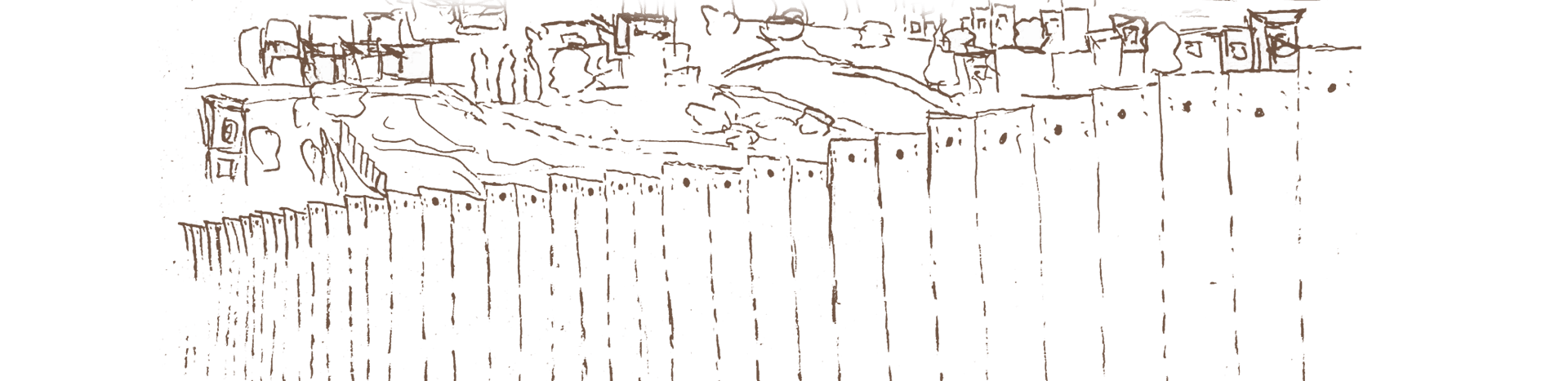
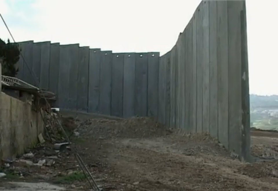
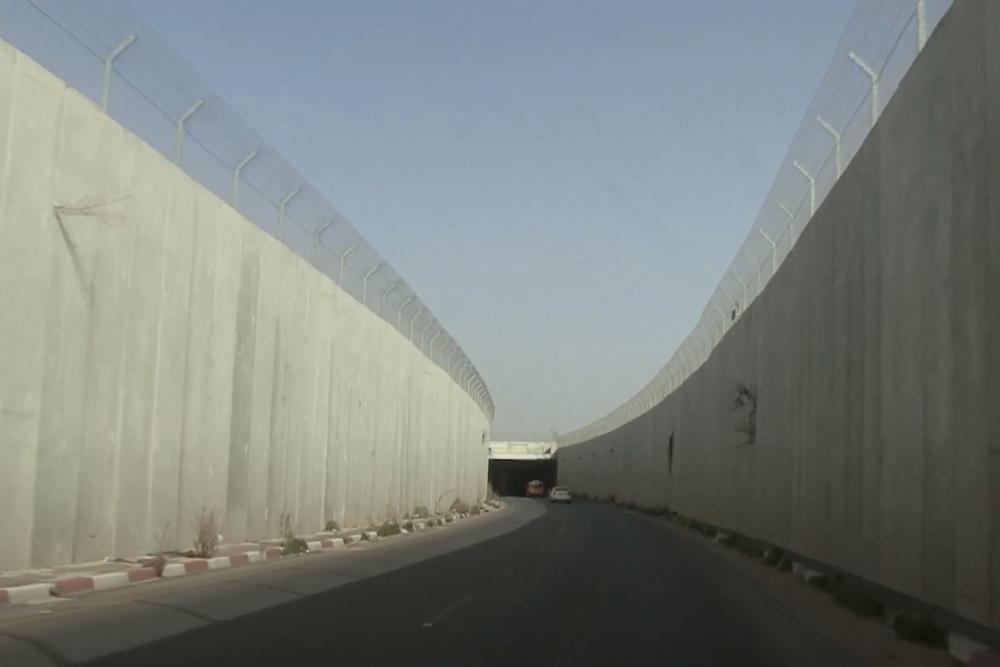
Israel's Separation Wall, called al-jidar by Palestinians, has drastically reshaped the geopolitical fabric of Jerusalem and its hinterland, enveloping Jews into the city and fragmenting and asphyxiating Palestinian existence in and all around it.
Featured in This Topic
Twenty years on, Israel’s Separation Wall has wholly reconfigured the geopolitical fabric of Jerusalem and its hinterland, shattering Palestinian communities, families, and lives.
An interactive map of the Separation Wall in Jerusalem and its environs
The story behind a tragic accident offers a window into a brutal settler-colonial landscape. A book review.
Grace under duress: How one kindergarten managed to adapt when Israel’s Separation Wall was routed right through its playground.
A generation’s labor is lost when the wall comes between a man and his business. A Photo Story.
The Hajajla family house in al-Walaja, built before 1967 with clearly documented ownership, could not be destroyed or evacuated. So the state invested millions to ghettoize it.
A powerful testament to the experience of living through the transformative and traumatic period when the wall was built in Jerusalem and its environs.
Life is unbearable for Palestinian residents of Khirbet Khamis, an enclaved village near Bethlehem surrounded by the wall and an oppressive checkpoint.
The wall destroyed the towns of ‘Anata and Bir Nabala by blocking their residents and severing them from their surroundings.
What happens when a suburb’s source of life and livelihood is choked off? The story of Bir Nabala offers a stark example.
The Story in Numbers
150,000
Estimated number of Palestinian Jerusalemites who have been separated from the city by the Separation Wall and must now access it through continuously congested, bottlenecked military checkpoints daily, even though they hold Israeli IDs and live within the city boundaries; this number is likely higher [1]
40
Estimated number of Palestinian localities in or around Jerusalem that have been excised (granted access to the city only through a single checkpoint—i.e., taken out of the city), enclaved (entrapped within the wall without Israeli IDs or legal access to the city), or totally engulfed (surrounded on all sides) by the Separation Wall’s meandering, asphyxiating route; [2] many have consequently been ghettoized
30
Number of Israeli settlements built illegally outside of Israel’s (unilaterally) expanded municipal boundaries that will be enveloped into the city by the wall’s planned route, connecting them to the 11 already existing Israeli settlements built within the municipal boundaries in East Jerusalem [3]
468
Estimated number of kilometers spanned by the entire portion of the wall that has been built to date (this is subject to change) [4]
228
Known number of kilometers remaining unbuilt in the planned route of the wall (this is subject to change) [5]
140
Number of kilometers spanned by the wall in and around Jerusalem [6]
52 out of 60
Number of kilometers of the wall made of concrete and stone found in the portion of the wall that encircles Jerusalem versus the entire West Bank (i.e., 87 percent), [7] showing that the portion of the wall built of concrete and stone is largely located in East Jerusalem, not further afield in the rest of the West Bank
97
Percent of the wall’s meandering route in Jerusalem and its close environs that breaches the Green Line (versus 85 percent across the entire West Bank) [8]
231
Number of square kilometers of Palestinian land that will be expropriated once the wall’s meandering route around the “Greater Jerusalem” area is completed (which equates to about 4 percent of West Bank land)[9]
Notes
1. B’Tselem, “The Separation Barrier,” November 11, 2017.
2. Calculation by the Jerusalem Story Team based on Table 1 in al-Jidar: An Instrument of Fragmentation.
3. Six settlements are enveloped into the city by the first layer of the wall (Har Adar, Har Shmuel, Giv’at HaChadasha, Giv’at Ze’ev, Beit Horon, and Har Gilo). Six settlements are enveloped into the city by the partially built, planned route to the East of Jerusalem (Almon, Kfar Adumim, Alon, Mishor Adumim, Ma‘ale Adumim, and Qedar). Fourteen settlements are enveloped by the planned route around the Gush Etzion settlement bloc (Beitar Illit, El’azarm Neve Daniel, Neve Daniel North, Giv’at Hadagon, Migdal Oz, Efrat, Giv’at Hahish, Alon Shvut, Kfar Etzion, Old Massu’ot Itzhak, Bat Ayin, Bat Ayin West, Rosh Tzurim, and Derech Haavot). These total 28 settlements that are outside municipal boundaries and are enveloped into the city by the route, partially built and partially unbuilt. However, these calculations do not include settlements that are still under construction, such as Har Gilo B in the Gush Etzion bloc and E1 in the Ma‘ale Adumim bloc. Nor does it include settlement outposts in these areas. About 11 settlements are within the (unilaterally expanded) Israeli municipal boundaries of East Jerusalem (Ramot, Ramat Shlomo, Neve Ya’akov, Pisgat Ze’ev, French Hill, East Talpiyot, East Talpiyot, Har Homa, Gilo, Ma’alot Dafna, and Ramat Eshkol). These calculations do not include settlement enclaves within Palestinian neighborhoods and settlement outposts around the city, such as the multiple settlement enclaves in the so-called holy basin area (e.g., Sheikh Jarrah and Silwan). In total, settlements enveloped into the city by the wall (both those in East Jerusalem and beyond the municipal boundaries), including those within the Giv’at Ze’ev, Ma‘ale Adumim, and Gush Etzion settlement blocs, amount to 41, excluding outposts and enclaves.
4. Based on a digitized map measurement using GIS and aerial photos conducted by the Jerusalem Story Team.
5. Based on a digitized map measurement using GIS and aerial photos conducted by the Jerusalem Story Team.
6. Based on a digitized map measurement using GIS and aerial photos conducted by the Jerusalem Story Team.
7. Frances Chiodelli, “Re-shaping Jerusalem: The Transformation of Jerusalem’s Metropolitan Area by the Israeli Barrier,” Cities 31 (2013): 419.
8. Based on a digitized map measurement using GIS and aerial photos conducted by the Jerusalem Story Team.
Palestinian men play a game of soccer next to the Separation Wall in Abu Dis.